Affected by the winter wave
in the Mojana Subregion
Implementation of the Methodological Strategy for Community Strengthening in Córdoba and Sucre
Municipalities of La Mojana
Hold down Ctrl + Scroll to zoom.
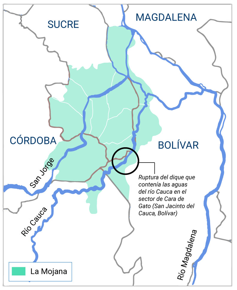
La Mojana is a subregion located in northern Colombia, encompassing 11 municipalities across the departments of Sucre, Bolívar, Córdoba, and Antioquia. This area is characterized by its extensive network of wetlands, which play a crucial role in regulating the flow of the Magdalena, Cauca, and San Jorge rivers. The wetlands of La Mojana are essential for flood mitigation and sedimentation, significantly contributing to the ecological balance of the region.
The La Mojana region in Colombia has faced multiple humanitarian emergencies in recent years, primarily due to recurring floods. Since August 27, 2021, when the breach of the Cara de Gato dike caused widespread flooding, more than 166,000 people have been affected. This situation has exacerbated needs in critical sectors such as health, housing, food security, and access to clean water.
The Pan American Health Organization (PAHO) has played a crucial role in responding to this emergency, supporting local authorities in crisis management. The floods not only destroyed homes and crops but also increased the risks of diseases such as dengue, malaria, and leishmaniasis due to the proliferation of vectors. Additionally, the COVID-19 pandemic further complicated the situation, increasing the need for medical care and psychological support.
The Colombian government has implemented various measures to mitigate the crisis, including technical assistance and national coordination to support the affected communities. However, recovery has been slow, and communities continue to face significant challenges in restoring their livelihoods and ensuring their dignity.
La Mojana: Humanitarian Emergency Due to Flooding
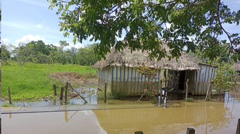
Since mid-April of this year, the La Mojana subregion has been hit by intense rainfall, leading to a significant rise in the levels of rivers, streams, and wetlands. This situation, exacerbated by the lack of maintenance of water channels and the breach of the “Care Gato” dike, has resulted in severe flooding affecting at least 27,039 people, 40% of whom are children and adolescents.
The most affected communities are located in the municipalities of San Jacinto del Cauca (Bolívar), Guaranda, Sucre, Majagual, San Benito Abad, San Marcos (Sucre), and Ayapel (Córdoba).
Limited access to these areas hinders the quick and accurate collection of information, slowing down the response of humanitarian organizations and reducing the effectiveness of assistance, both in terms of reach and addressing specific needs.
Amid this crisis, the community support and strengthening process led by the Local Coordination Team (ELC) – Córdoba has enabled communities to begin conducting their own censuses to identify damage and impacts. This effort has been supported by 3iSolution through its Community Engagement strategy to enhance the response and assistance to those affected.
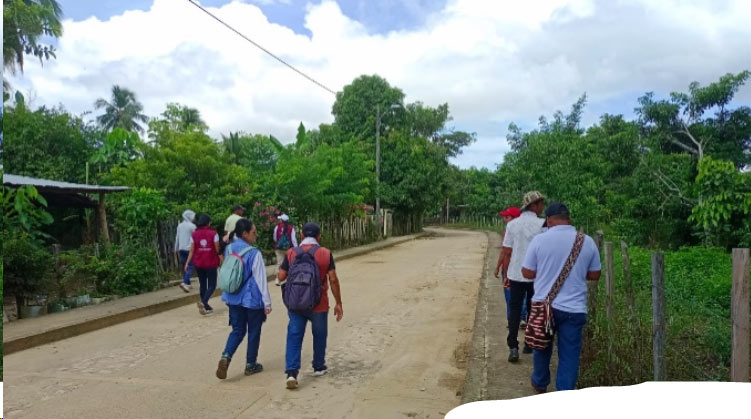
The Community Engagement Strategy aims to enhance community capacities for information management, with the goal of achieving effective ownership and improving humanitarian response. This approach is evidence-based and tailored to the specific needs of the territory.
In Sincelejito, a corregimiento within the municipality of Majagual, the community implementation of this strategy began. During this process, the president of the Community Action Board (JAC) proposed extending the strategy to other leaders and JAC presidents across the La Mojana subregion. These leaders are organized into the “Alianza Comunal Mojana,” a network of over 300 leaders from the four departments of La Mojana, working on developing advocacy actions on risk management issues.
In this context, we trained 40 participants in a face-to-face workshop on geolocation and information collection tools using OsmAnd and KoboToolbox.
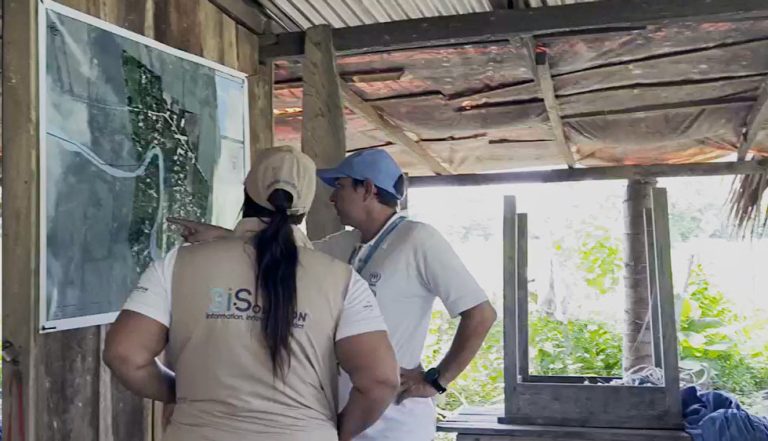
To implement the data collection exercise, two months later, 3iSolution conducted an assessment on the impacts of the El Niño phenomenon and the community capacities within the context of this phenomenon.
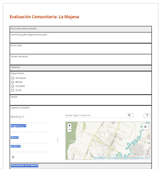
Leaders from 37 communities in La Mojana completed the survey to identify vulnerability during the dry season and highlight elements of organizational capacity for managing disaster risks in preparation for the upcoming rainy season.
In addition to the capacity built within the communities, this exercise resulted in the creation of the “Effects of the El Niño Phenomenon in the La Mojana Subregion” dashboard.
This dashboard is continuously updated and shared with both the communities, to support their advocacy efforts, and with the Local Coordination Team (ELC), to serve as an information tool for the actions implemented in the territory.
Community Response in La Mojana: Data Collection Amid the La Niña Emergency
In response to the current emergency caused by the La Niña phenomenon and the severe impacts it has had on the La Mojana subregion, local communities have initiated a data collection effort to assess damage, losses, and needs through the Junta de Acción Comunal Mojana. This initiative promotes the use and application of data collection tools that were previously shared, transferring this training to other leaders who did not participate in the initial exercise facilitated by 3iSolution.
For this process, the presidents of the Community Action Boards (JAC) developed a series of questions designed to create community censuses detailing damages, casualties, and specific needs, taking into account the differential approaches required.**
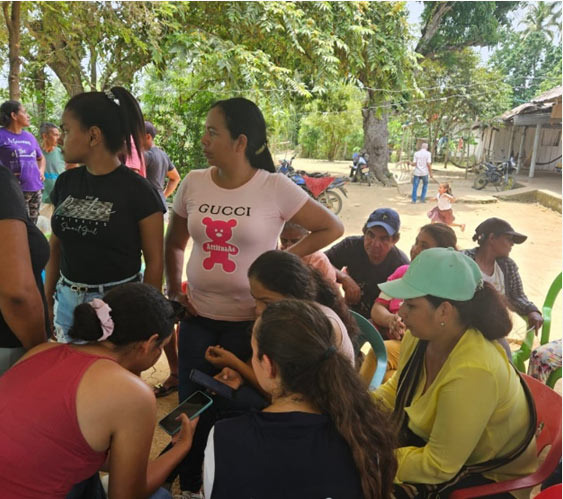
Subsequently, the United Nations Office for the Coordination of Humanitarian Affairs (OCHA), together with the Local Coordination Team (ELC) of Córdoba and 3iSolution, collaborated to provide technical support in the development of the Community Assessment for the La Mojana Subregion in June 2024. Additionally, these organizations oversaw the data collection process and verified the information with the affected communities to ensure the accuracy and relevance of the findings.
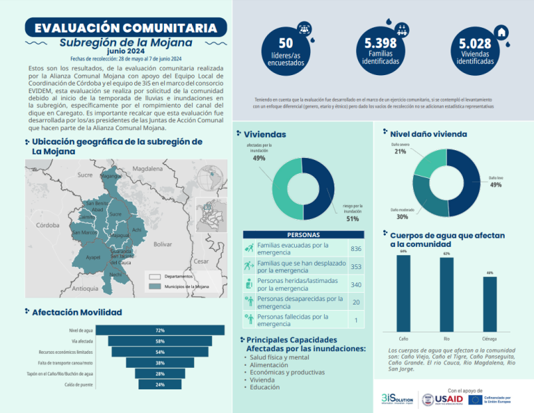
These exercises not only demonstrate the appropriation and strengthening of community capacities in the use of information management tools but also enhance community work by generating reliable data from primary sources. Additionally, they improve the efficiency of information collection processes through the use of virtual tools.
Strengthening Community Capacities in Information Management: This process has enabled the identification of community capabilities through the use and appropriation of tools, allowing for effective data collection during an emergency. Continued strengthening of these capacities is essential.
Coordinated Interventions: Interventions in the territory must be coordinated among the government, public and private entities, communities, and international organizations, under the principle of shared responsibility.
Inclusion in Planning and Response: It is crucial to include La Mojana communities in territorial planning exercises and in the implementation of response measures.
Community Education: Educate communities on risk management and mitigation plans, as well as environmental awareness. This includes fostering a participatory culture in environmental protection and water resource management.
